
My regular readers know I’m a big fan of webcams in the area between north Denver and Rocky Mountain National Park. And perusing personal weather stations has turned up two more in addition to the one in Nederland that I found in November.
The view from the Cherryvale weathercam in Boulder is especially lovely today. There’s been heavy snow in the mountains but today the sun is out. The camera is located just north of Baseline Reservoir and looks west toward Sugarloaf Mountain and Boulder Canyon. As you can see in the screenshot, the Continental Divide, on the horizon, is solid white with snow. Closer to the camera, the gently rounded, white (because there are no trees) little mountain at the exact center of the shot is Sugarloaf. My brother lives just over the crest on the west side and has described the mountain, very poetically, as looking like a woman’s breast. Boulder Canyon is to the left (south) of Sugarloaf. The mountain is bare in part because of a forest fire in the 1980s that spread up out of the canyon. The top has always been a bare, rocky prominence. I learned just this year it’s because the mountain is an old lava dome that pushed up eons ago. No eruption or lava flows, just a dome with unrealized aspirations.
Then there’s Truta’s weathercam in Estes Park, actually a rediscovery. I found it some years ago, then lost track of it. Now I’ve found it again, and it has a much larger image than before. It appears the camera is located on the northeast side of Estes, north of Lake Estes, and looks roughly south southwest toward Prospect Mountain (elev. 8.900 ft.) and the Longs Peak massif just visible behind it. The white track up Prospect’s flank is an aerial tramway to the summit. Quite the tourist attraction in the summer.

My updated list of favorite north Colorado webcams (refresh times vary):
- Allenspark, Colo. (elev. 8,500 ft.) — Subject to change but usually looks west toward Wild Basin in Rocky Mountain National Park. Mt. Meeker (Longs Peak massif) is on the right. When I was growing up, family vacations were spent in Allenspark.
- Alpine Visitor Center (elev. 11,796 ft.), Trail Ridge Road, Rocky Mountain National Park
- Boulder, Colo. — Cherryville weather station. Looking due west toward Boulder Canyon and Sugarloaf Mountain (elev. 8,917 ft.)
- Boulder Valley, Colo. & the Flatirons — Looking west from Louisville, Colo.
- CDOT cams near Ward (Hwy 72), Lily Lake (Hwy 7), and Sleepy Hollow (Hwy 34)
- Continental Divide, Rocky Mountain National Park — Looking west from Glacier Basin campground (elev. 8,500 ft.)
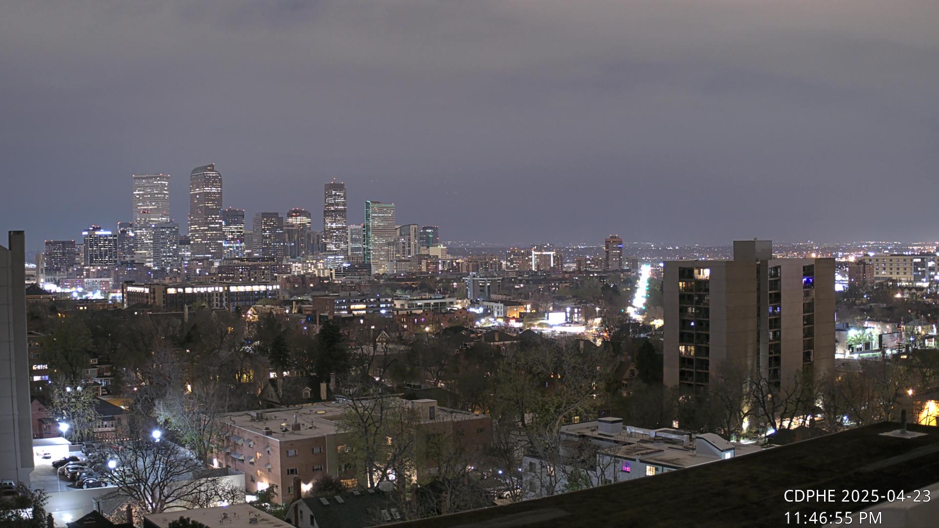
- Downtown Denver, Colo., skyline — Looking WNW
- Estes Park, Colo. (elev. 7,522 ft.) — multiple live webcams in Estes (views can be enlarged to full screen size)
- Fall River from Castle Mountain Lodge bridge, Estes Park, Colo.
- Longs Peak (elev. 14,255 ft.), Rocky Mountain National Park, Colo. — View of the East Face aka “The Diamond”
- Nederland, Colo. — Looking west from private weather station
- Truta’s weather cam — Estes Park, Colo. On the NE side of town looking SSW toward Prospect Mountain and Longs Peak
- TundraCam, Niwot Ridge, Colo. (controllable camera!) — 360 degree view from 11,600 ft.
- YMCA of the Rockies, Estes Park, Colo. — Two cameras. The first looks east from high above the YMCA property. The second looks west from the YMCA property (elev. 8,010 ft.).
- Ypsilon Mountain (elev. 13,520 ft.), Rocky Mountain National Park, Colo. — Camera looks NW from Windcliff Properties in Estes Park
_______________________________
OCTOBER 4, 2025: Don’t miss my improved webcam page: Colorado webcams from Rocky Mountain NP to Pikes Peak
Wow PT, you really stay on top of this stuff! 😀
It’s cheaper and easier than driving to each location. 🙂
Absolutely! 😀
HA! I was just looking at the YMCA ones yesterday. (and at places that allow dogs to stay – only allowed to hike in national forests now….Oh, to be rich and to be able to afford one of those large motorhomes…and a driver!) Thanks for the updated list…I can always drool and sigh.
Yeah, I do a lot of that.
P.S. There were a number of advantages to staying in Allenspark. It’s away from the touristy crowds in Estes and it’s right on the edge of the park, so we could easily hike into Wild Basin if we wanted to but otherwise weren’t bound by park restrictions on pets, campfires, etc. It’s also higher and cooler in the summer. Of course, it’s not the same as it was 50 years ago. The “new” highway bypassed it and most of the little businesses there died. The lodging that’s still there is quite rustic.